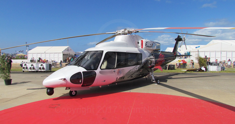
Having maintained this blog since 2016, given the experiences since then, it's reasonable to conclude that the Australian and State governments and some local governments only reinforce bushfire mythology, neglect their prevention responsibilities, fail to implement a full PPRR risk management approach to mitigating bushfire, shortcomings proven in the devastation of Wye River–Separation Creek on Christmas Day 2015 and Yarloop, WA, on 7 January 2016. And elsewhere since then.
Following on from my Tuesday, 28 March 2017 posting "Wye River–Separation Creek bushfire — lightning strike and what to look for", where would one take an independent investigator to stand at the top of a “gorge” to demonstrate “inaccessibility” and point out the scene of a lightning strike through tree canopies that are very largely unaffected by a fire?
If one wanted to point out a “gorge” one would drive along the relatively sedate Cumberland Track off Wye Road via Curtis Track or maybe come in from the Lorne end if that’s not too rough. It’s certainly a very steep drop down off the southern side of Cumberland Track in places.
Or maybe drive along the relatively sedate Jamieson Track off Wye Road to impress with a steep, to some, drop off from the northern side of that track.
Below are two photos of the northern side of Jamieson Track near where the drone was flown.
One would hardly have the investigator bounce along a steep in a couple places and dusty bulldozed track to show a gorge that does not exist on the southern side of Jamieson Creek. A track that leaves Wye Road in the condition as shown in the following photograph.
And further along that track to where I parked my vehicle, and from where easy access to the site of the lightning strike as shown in my posting on Tuesday, 28 March 2017 "Wye River–Separation Creek bushfire — lightning strike and what to look for" can be achieved on foot. Photographs in that posting show the slope that I've calculated from the 1:30 000 topographical map to be approximately 15 degrees down towards the north and north of northwest and Jamieson Creek at the foot of the slope.
And further on towards the northeast from where my vehicle is parked.
If one had access to a helicopter the investigator could be flown over the whole fire area to impress, while avoiding providing access to enable the investigator to actually ‘walk the ground’ around the lightning strike.
The government's position on inaccessibility, fact or fiction? Fiction!
A case of operational dysfunction?
I've recently seen an email from DELWP to a citizen who suffered loss from the Wye River–Separation Creek bushfire that includes the following statement: "as they [EMV] were the lead control agency of the Wye River-Jamieson Track fire".
Raises questions of competence and the possibility of operational dysfunction right from the beginning of the lightning strike. And opportunism?
Finally, what drives me? Costs involved with bushfire continuing to rise due to emphasis on response and recovery rather than prevention by governments at all levels, as covered in this story in the 12 April 2017 edition of The Australian.
Note the large burnt stump visible at left in the photograph.
My objective was to illustrate that there was nothing difficult about the terrain in the general area of the lightning strike that would have prevented physically fit, experienced and safety conscious DELWP firefighters and also that the vegetation was not too dense to prevent effective use of suitable and properly tasked water bombing aircraft.
I've been seeking advice on lightning strikes and what to look for to be as sure of my facts as possible and provide the following examples, and there are many more, of what I've studied:
"Science Made Simple" that includes an informative video of the details of a lightning strike.
Concerning the Jamieson Creek lightning strike, I find the following in the National Geographic discourse describes the situation found that I alluded to with my reference to the "large burnt stump":
Lightning's extreme heat will vaporize the water inside a tree, creating steam that may blow the tree apart.
This is the remains of the tree that I believe took the brunt of the lightning strike.
Plate 1
The burnt stump shown at left in the first photograph in this posting is at left in Plate 1. The fallen tree in the centre has separated from the stump. The damaged stump in the centre appears to have been damaged by the fallen tree to its left.
Note the severe burn isolated to the lower part of the tree. This deep, small area of burning is consistent with the intense heat from a lightning strike at or near the base of the erect living tree—lightning does not necessarily strike the top of a tree, it all depends on where the upwards moving positive charge “streamer” emanates from, and it could even be the ground alongside a tree or an isolated rocky outcrop.
Plate 2
Plate 2 is another view of the stump and its fallen top as indicated.
Plate 3
Plate 4
Plates 3 and 4 show the stump. Note the depth of the charring, particularly concentrated at the left side of the stump.
Plate 3 also shows the damage caused by a violent separation of the tree from the stump, almost as if the result an explosion.
Back to the tree; it was a living gum—EVC 201:Shrubby Wet Forest from Biodiversity Interactive Map - 3.2 indicates Mountain Grey Gum Eucalyptus cypellocarpa and checking Leon Costerman’s Native Trees and Shrubs of South-Eastern Australia satisfies me—containing moisture that would have required far more and prolonged exposure to heat of a level that's not associated with a fire moving across the ground to produce a burn of this depth.
I suspect it was a relatively mild fire for those first couple of day, as logs and larger stumps already on the ground in the area had suffered little more than superficial charring, as Plates 5, 6, 7 and 8 show.
Plate 5
Plate 6
Plate 7
Plate 8
An explanation for the seemingly burnt trees. Scattered within the area are Messmate Stringybark Eucalyptus obliqua that account for a few trees with blackened trunks, which is due to the fibrous bark but not the trunks burning. Plate 9 is an example of Messmate Stringybark from the Christmas Hills area.
Plate 9
Costerman describes the bark of the Mountain Grey Gum as:
Smooth, grey often with yellow and whitish patches, sheds [bark] in strips or plates; may be rough and darker at base.
Plate 10 shows the relatively easily ignitable roughness at the base of a Mountain Grey Gum (or very similar) and becoming plates or strips further up the trunk. Sufficiently dry and standing off from the trunk can see fire extend further up the trunk to involve this bark without igniting the trunk. The arrows indicate examples of the stages of bark from the ground up.
Plate 10
Plates 11 and 12 show the unburnt vegetation to the west and on the opposite side of the control line from the fire area, photographed at similar level to the lightning strike.
Plate 12 shows bark renewing itself on Stringybarks following much earlier exposure to fire.
Plate 11
Plate 12
Photos in this and recent postings show that there was nothing difficult about the area for fit and experienced DELWP firefighters to round up the initially small fire in the first couple of days, and to argue that the vegetation was to dense to respond to proper air attack is arrant nonsense if DELWP's use of water bombing aircraft in Gippsland in recent days is any guide.
The annotated Google Earth photo shows the way to where I believe the lightning struck: Position 11. Not difficult to find nor hard to reach on the ground, but always with an eye upwards at the trees above. And approximately 250 metres from a well-formed four wheel drive track.
Why then the failure to slay the Jamieson Creek beast in its infancy?
On page 27, third paragraph under the heading "Initial fire control strategy 19–21 December", in the "IGEM's Review of the initial response ..."
Through the period 19 to late 21 December, the IC's [Incident Controller] broad strategy was to establish bare earth containment lines to limit the fire's spread within the area bounded by the Cumberland Track to the north, and Jamieson Track to the south.
As can be seen in the following annotated Google Earth photo, the area of land between Cumberland Track and Jamieson Track is huge compared to the size of the fire on 19 December.
Why this plan so early and probably before the Incident Control Team really knew what they had to contend with?
Inexperience, incompetence, panic, interference from above, budget restraint or was the Incident Controller 'marching to the beat of a different drummer' — sign found at the corner of Curtis Track and Cumberland Track on 9 January 2017?
And the following sent to me by Andrey in response to my posting of Monday, 20 March 2017 with the important part reproduced verbatim except for the asterisks:
Your experience, analysis, and persistence in providing this information is the only relief I can embrace in the ongoing misery that sees me leaving my Wye River home of 15 years.
I can't afford to rebuild and adding insult to injury, I'm forced to spend tens of thousands of dollars on a "minor work order" to stabilise my land against erosion and slippage. This is money I don't have, nor will ever recoup. Alas, it is only money. What is more important is the subsequent breakdown of my relationship with my partner/kids and general well-being.
Whilst I realise it may be human nature to want to blame others for one's misfortune that will not return the life I had. I believe in being accountable for my actions and hope that lessons shall be learnt from this debacle.
The information you provide rekindles the thoughts and feelings I had very soon after that black christmas day, the same thoughts and feelings that ******* so expertly managed to politicise in the aftermath.
I know Peter Jacobs and am very happy to air his "rhyme". Andrey I do not know personally, but am satisfied that his is from the heart. I imagine there are many similar stories out there.
Finally, this posting is not about self-promotion but providing a platform for a few people to tell their stories—some of which I find heart-rending—people who unlike the government and its agencies can't whistle up the media whenever they choose.
In pursuing the truth about a fire that's caused and continues to cause so much despair, disruption and cost to individuals and the public purse within and beyond Wye River–Separation Creek, to echo Minister Garett, "what are the learnings from this fire"?
Surely an important matter is how the Emergency Management Commissioner and DELWP decide on "inaccessibility" when it comes to fighting a fire in a forest.
In my blog posting of 3 February 2017 "Wye River–Separation Creek bushfire — fake news and alternative facts at play?" I provided information to support my contesting the "assertions of the Emergency Management Commissioner and Inspector-General for Emergency Management (IGEM) that the lightning strike that impacted just south of Jamieson Creek was ʻextremely difficult to accessʼ and arguing that the vegetation was too dense to respond to the efforts of firebombing aircraft".
Included in that posting are a series of photographs taken on driving into what I then considered was in close proximity to where the lightning strike reached the ground on 19 December 2015 and demonstrating by my presence that the area would not have been difficult nor too dangerous for fit and experienced DELWP firefighters.
Also in the posting are an extract from the 1:30 000 Vicmap Topographic Map of the area and other relevant maps and drawings:
Having finished exploring further east along the bulldozed track from where my vehicle was parked, I then went back to explore what lay down the trail indicated by the sign painted on the tree below.
As I walked down the trail it seemed soon to become a hand-made control line that would have been taken down to "mineral earth" or bare ground. The objective of the control line would have been to prevent the spread of a surface fire or be used as a base for burning out the grass, leaves and twigs: surface fine fuel between the fire edge and control line. It's the surface fine fuel that normally carries the fire front.
The control line would have been constructed as close to the fire edge as safely possible to minimise the size of the fire.
From my walk down the trail I recorded a few points with my GPS and took photographs. Concerning the GPS recordings, it's important to understand that the forest canopy and positions recorded increasingly further down the northern slope probably shielded some of the satellites able to be read, which will result in a reduced accuracy of the recordings. Nevertheless, I’m satisfied that they are sufficiently close for my purposes.
Following is an annotated Google Earth photo with Positions 6, 7, 8, and 9 that I’m confident mark the bulldozed that becomes the hand constructed control line put in place early, probably 19 and early on the 20th. Positions 10 and 11 are inside the fire edge east of the control line. I consider Position 11 is the approximate location of the lightning strike. More about this later.
Next, part of the 1:30 000 topographical map where I have located Position 11 from my GPS recording. Position 1 is where I parked my motor vehicle Position 2 is the location of the sign on the tree pointing to the hand trail (above.
Now a few photographs down the control line. The first is near the head of the control line and close Position 2 on the map. The fire area is to the right of the line. The second is further down the control line. The uninvolved area is to the left of the line. Important to understand that when the line was constructed it would have been cleared to “mineral earth” (bare ground).
Next, a view of the fire area east of the control line part way down towards position 9 on the Google Earth photo.
And further into the burnt area from the immediately preceding photograph.
Another view similar to the preceding photograph inside the fire area as I made my way to Positions 10 and 11 from Position 9 on the Google Earth photo and eventually back to Position 2.
On fire behaviour on the 19th and probably the 20th, the three preceding photographs show unburnt heavier fuels laying on the ground, much of which was in place before the fire. This indicates to me that the fire was not all that hot and it just “trickled” around, probably not all that affected by wind experienced that far downslope.
Finally, a photograph towards the northeast across the area where I feel the lighting strike occurred. Note the large burnt stump visible at left in the photograph.
And, on accessibility and density of vegetation working against effective fire attack while the fire was still small, my photographs don’t seem to support the assertion that the lightning strike that impacted just south of Jamieson Creek was "extremely difficult to access" and argued that the vegetation was too dense to respond to the efforts of firebombing aircraft. But you be the judge, I have my opinion.
As we shall see later, the fire eventually became enormous and ultimately led to the Wye River–Separation Creek catastrophe.
Don't be misled by the "spinners" folks, regardless of where and how the fire that caused that catastrophe came from on Christmas Day, it was the failure to quickly control and extinguish the fire caused by the lightning strike during those first few hours that was the underlying cause of what is now the Wye River–Separation Creek misery.
The Quadrant story A Tale of Two Fires by Mark Poynter provides a different view to those expressed by the IGEM and the Emergency Management Commissioner. You can decide for yourselves on who is most qualified.
Finally for now, the penultimate paragraph in Minister Garrett’s request to the IGEM:
I understand that you and your staff were in attendance at this fire over a number of days conducting monitoring and evaluation functions as part of your legislative role and that a number of observations were made relative to those issues listed above.
Is this statement correct? Does the IGEM have people at the fires currently burning in National Park west of Dargo in eastern Victoria, and further east in National Park at Wulgulmerang? Does the IGEM have people appropriately qualified and experienced to undertake such important work?
There are important matters that should be pursued by the Coroner, if she ever gets around to it. For example are there still people in critical fire management positions who should have been removed?
Will it eventually be found that Minister Garrett and the people of Victoria have been misled?
fourth paragraph beneath the heading "1.1 Observations – Fire control", page 3;
"OBSERVATION 1 – INITIAL ATTACK", page 3;
right side column beneath the concluding "RECOMMENDATION 3", page 4;
third paragraph down in the right side column on page 5;
right side column beneath the heading "Landscape and fire history" on page 11;
left side column beneath the heading "Detection of the fire 19 December", particularly the third paragraph mention of a "complex gully system" on page 12;
beneath the heading "Backburning strategy 22–23 December" on page 14;
beneath the heading "Use of aircraft", particularly the paragraph in the right side column "Helitacks are suited to the Otways terrain ... get close to the canopy. The long line and bucket capability ... extinguishing fire and hot spots" on page 21;
beneath the heading "4.7 Firefighter safety" on page 21;
1. Inaccessibility and vegetation density
Thinking more about what I wrote beneath this heading in my 3 February 2017 posting reminded me of the refashioning of the CFA following the 1962 fires, with the appointment of Brigadier R T 'Dick' Eason MC as the CFA's first permanent Chairman.
Dick Eason pulled the CFA up by its boot straps by bringing a military approach to fire control operations. I remember his first output was modifying the principles of war to be CFA'S Principles of Operations:
MAINTENANCE OF THE AIM
FORESIGHT
SPEED
FLEXIBILITY
SECURITY
ADMINISTRATION
MORALE
MOBILITY
CONCENTRATION
ECONOMY
CO-OPERATION
COMMUNICATION
The principles of operations were eventually enshrined in the CFA's 'little red book':
Application of the principles of operations was also included in the 'red book':
So, where did the failure to control the fire started by the lightning strike begin?
In the "Seven Cardinal Sins in Firefighting" (above) I've highlighted where I contend the failure began, and that failure began on 19 December 2015, being the initial response to the lightning strike.
It was drummed into me from my beginning at CFA that response to an outbreak of fire must be with "speed and concentration" to deal with the fire while it was small and still developing. Being "flexible" with that response to suit the circumstances can also be critical.
Known from the outset to be remote from vehicular access, "flexibility" of attack should have seen a DELWP helitack crew dispatched to the scene as a first responder, rather than wait until a bulldozer could construct a track.
Examination of the following would have shown to anyone with knowledge of map interpretation and terrain that a helicopter landing zone could have relatively quickly been constructed by a rappel crew lowered in and firefighting well advanced by the time the bulldozer arrived:
And, there was plenty of area available where a helipad could have been constructed, I parked my vehicle in one such area:
Next, we need to consider the principle of "concentration" or weight-of-attack. Weight-of-attack is the dispatch of sufficient firefighting resources to deal with an outbreak of fire.
In responding to an alarm of fire CFA and MFB always dispatch vehicles to match the task, be it bushfire, house fire, factory fire, hazardous materials incident, etc.
On a day such as 19 December 2015, a day warranting a total fire ban declaration covering the Jamieson Creek area, the CFA's immediate response would have been several tankers to an outbreak of bushfire and built up as the circumstance of the fire became known to warrant an increase of resources.
With the weather predicted the following day already known and to be another day of total fire ban, why was the initial response to the fire so limited in view of the eventual downstream consequences? But more about the downstream consequences later.
I consider the response to have been limited because of the information on the EMV 19 December 2015 briefing map below:
People: 55
Appliances:7
Aircraft: 2
Hectares: 0.5
Tankers with wings
From a weight-of-attack perspective the CFA recently described firebombing aircraft as "tankers with wings".
Applying the CFA vernacular, as wheeled tankers were unable to reach the lightning strike until a bulldozer had constructed a track, a prompt and "foresightful" response should have seen "winged tankers" in number and capability to the task committed as first responders.
Response capability to match the threat environment
While the information on the EMV map states two aircraft, how many of those aircraft were capable of putting "wet stuff on the hot stuff"?
It's reasonable to assume that only one of those aircraft was capable of dropping water or retardant on the fire, the other aircraft would have been performing the "bird dog" or managing the drop role. So, one "tanker" where in country under the control of the CFA many tankers could have been expected to be involved.
If only one firebombing aircraft, what were the people in charge of this fire thinking, especially when they should have been aware of the weather conditions forecast for the next day???
And, what firebombing capability aircraft was involved? Is it correct that a Bell 212 helicopter with 1,400 litre belly tank was dispatched from Bendigo?
Why not more than one "tanker with wings" dispatched, particularly one of the high capability Erickson Skycranes with 7,500 litre tank that I understand was sitting idle in the Melbourne area?
The Skycrane is a strong aircraft that can fly in wind or turbulence exceeding the capability of the smaller helicopters. It also has the capability to fill its tank by lowering the scoop visible alongside the tank into the water while hover-taxiing forward, thereby forcing water into the tank more efficiently than the pump at the end of the suction hose, and there was an endless source of water, being the sea a short flight to the east.
On the vegetation being too thick for water or retardant dropped from a helicopter to penetrate.
It’s not hard to imagine the effect of a hovering Skycrane emptying its 7,500 litre tank — assuming that quantity of sea water is approximately 7.5 tonnes – as shown in the above photograph on fire burning on the ground around the lightning strike as shown in the following photographs, the leaves and finer limbs would likely be stripped from the trees as the water crashed to the ground, "drowning" the fire.
Clearly, much more to cover but I'll finish for now with the following: